Concept
A high-capacity automated monorail from Highpoint to Chadstone via Footscray, Southbank, Queens Road, Dandenong Road & Caulfield as part of the Melbourne Skyrail proposal.

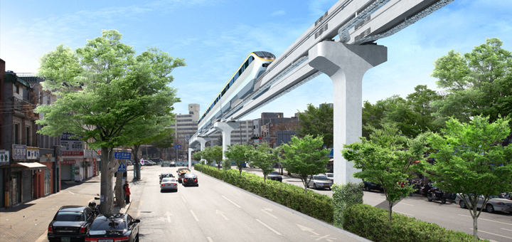
Art rendering of the new Daegu Monorail, South Korea (image reversed). This could be Melbourne. (Original Image: Daegu Blog) |
This monorail provides all the benefits of the proposed $9 billion heavy rail subway from Footscray to Caulfield at around 10% of the cost per kilometre.
- Eight-carriage trains every three minutes: Adding new east-west link through the congested heart of Melbourne.
- High-Capacity Transit for St. Kilda Road: This monorail passes over Queens Road augmenting tram services on St. Kilda Road.
- More Rail Capacity: This monorail replaces a number of rail stations allowing rail services to better service outer suburbs and regional centres.
- High-Capacity Transit for Highpoint: Direct access to Highpoint Shopping Centre from the city & Footscray.
- High-Capacity Transit for Chadstone: Direct access to Chadstone Shopping Centre from the city & Caulfield and access to the proposed Chadstone Link Monorail.
- Better value than the Melbourne Metro: This monorail would service far more than the proposed Melbourne Metro.
Cost
Our current cost range estimate is between $1 and $1.4 billion for all monorail components. This estimate is to be further refined by ongoing analysis.
Resident Benefits
Home-owners near the monorail line receive the following benefits depending on their proximity to the monorail track:
- Removal of overhead power and other wires which are to be relocated underground.
- A daily payment during construction of the monorail outside their properties.
- A monthly payment for the life of the monorail system related to ticket sales for residential property within 20 meters of the track. This is anticipated to be between a few hundred and a few thousand dollars per annum depending on proximity to the track.
- A vegetated tree-way under the monorail track and extra trees along the sides of the street where possible.
- Extra public transport in their area.
Approximate Route
The approximate route of the proposed Highpoint - Chadstone Monorail is shown below. Click into the map to zoom in on particular segments.
|
View Highpoint - Chadstone Monorail in a larger map Approximate route of the Highpoint - Chadstone Monorail. |
Destinations and Connections
In about 24 kilometres this monorail services many significant destinations across Melbourne. Under the guideway major new plantings of trees and shrubs are to be made, light poles and overhead power lines are to be removed. Light fittings are then mounted on the monorail pillars improving overall aesthetics.
- Highpoint Shopping Centre: This station provided service to the shopping centre and the Homemaker Centre.
- Guideway passes over Highpoint Shopping Centre, Gordon Street and then over park land.
- Maribyrnong: This station links to the No. 82 Tram.
- Guideway passes over park land and along the Maribyrnong River under the high voltage power lines (which cannot be removed).
- Footscray: Servicing the TAFE College, Footscray and Flemington Racecourse.
- Guideway passes over park land and the Maribyrnong River and along rail lines to Mc Clure Road.
- South Kensington: Replacing the railway station which allows all rail services to run express from North Melbourne to Footscray.
- North Melbourne: The railway station and interchange for all Northern and Western rail lines.
- Guideway passes over trees on the Spencer Street median strip.
- Southern Cross Station: The monorail station would be above the DFO within easy reach of Southern Cross station, the CBD and the docklands.
- Guideway passes high over Spencer Street to the west of tram lines. Several parking spaces removed on west side here. The guideway goes over the rail viaduct.
- Crown Casino: The west end of the Casino near the Melbourne Exhibition Centre.
- Guideway passes over casino buildings until over Kings Way. Support pillars fitted between elevated road sections and then along central median strip next to tram lines.
- South Melbourne: Near Park Street and No.55 Trams.
- Guideway continues on central median strip or west-side service lane median strip avoiding tree loss.
- Queens Road: Near Arthur Street Street with foot bridges servicing St Kilda Road and Albert Park Lake. View site.
- Guideway continues on west side of Queens Road between the trees and the lake except between Union road and St Kilda Junction where it returns to the central median strip.
- St Kilda Junction: Over the tram and road junction allowing interchange to tram and bus services.
- Guideway continues on median strip.
- Windsor: Near Windsor railway station. Interchange with Dandenong Road and Chapel Street trams.
- Guideway continues on median strip just over trees with no tree loss.
- Malvern: Interchange with the Frankston railway line and No. 16 and No. 64 trams.
- Guideway passes over rail lines and then between rail line and Dandenong Road just over trees with no tree loss.
- Caulfield: Interchange with Dandenong and Frankston railways and No.3 trams.
- Guideway passes over St John Monash Drive and then along the Dandenong Road median strip with no tree loss.
- Carnegie: Replacing Carnegie railway station.
- Guideway continues along the Dandenong Road median strip.
- Chadstone: Interchange with the proposed Chadstone Link Monorail.

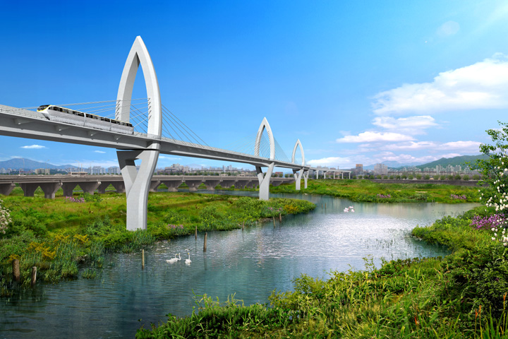
Art rendering of the new Daegu Monorail, South Korea. A shorter version of this bridge could take the monorail across the Maribyrnong River or the Yarra. (Original Image: Daegu Blog) |

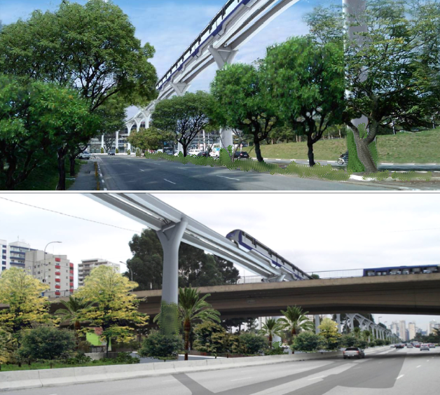
Art rendering of monorail track suitable for Australian cities. (The original Image was for the new monorail in São Paulo, Brazil: Skyscraper City) |
Travel Times
The high-capacity monorails under consideration have a maximum operating speed of 80 km/h. Assuming 10-second dwell times* at the stations the following travel times are likely:
- Highpoint - Chadstone: About 24 minutes (~24 km).
- Highpoint - Southern Cross: About 9 minutes (~9 km).
- Southern Cross - Chadstone: About 15 minutes (~15 km).
(*Similar to dwell time for trains and flat-floor trams.)
Capacity
Monorail capacity is discussed here. This monorail link should start with a high capacity using eight-carriage monorail trains from the outset to achieve a carrying capacity of over 15,000 passengers per hour per direction.
Eight-carriage trains which would be about 100 meters long.
Rail Line Implications
Some destinations are now serviced by this monorail enabling the rail system to better service outer metropolitan and V/Line destinations.
- Express Footscray to North Melbourne: As South Kensington is on the Monorail all rail services can run express between Footscray and North Melbourne.
- Six Less Stations on the Dandenong Line: Given that there are four tracks between Caulfield and South Yarra all Dandenong line trains should always run express between Caulfield and South Yarra now. Providing a monorail station at Malvern means makes this more feasible. Carnegie rail station can be closed as it is adjacent to Carnegie monorail station. Hughesdale is better served by the Chadstone monorail station, especially if the Chadstone Link Monorail is also built. (Note also that the current Hughesdale rail station is less than 900 meters from both Oakleigh and Murrumbeena stations.)
This leads to all Dandenong-line services having up to six less stops and hence more capacity to serve the outer suburbs and the Latrobe Valley.
Possible Extensions
- Extension West: At the Highpoint end the line can easily be extended to service suburbs between the Maribyrnong River and the Airports.
- Extension East: At the Chadstone end the line can easily be extended along Ferntree Gully Road to Knox City shopping centre and beyond.